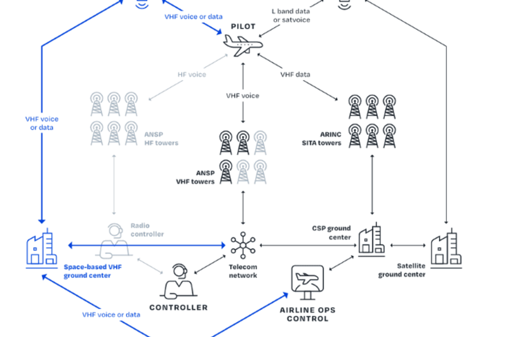
Aireon plans to build an equatorial satellite constellation, the second phase of its roll out of space-based VHF communications for the aviation sector, the company has announced at Airspace World 2025 in Lisbon, Portugal this week.
Aireon will launch up to 20 satellites in 2028 which provide air traffic surveillance and commercial data capabilities as well as VHF communications. The satellites will enhance space‑based automatic dependent surveillance-broadcast (ADS‑B) coverage, multilateration accuracy, and overall data resiliency for aviation customers.
“As the only company in the world that has developed, launched and certified an operational, safety-grade surveillance network from space, Aireon is positioned to bring space-based VHF communications from concept to reality. This constellation is a natural extension of our current network to bring enhanced capabilities to our customer base,” said Don Thoma, Aireon CEO.
Aireon is identifying companies to developers the satellites and associated systems.
Last year the company launched a space-based VHF consortium that includes NATS, NAV CANADA, AirNav Ireland, Iridium and others. In the past year, the group studied the business case, technical feasibility and concept of operations for VHF, leading to a filing for a spectrum license with the ITU.
Aireon and its partners have worked in close coordination with regulatory and standards-making bodies, including the International Civil Aviation Organization (ICAO) and others.
Michael Garcia, Aireon’s chief innovation scientist, said, “Space-based VHF holds a great deal of promise for the aviation industry, and it’ll take an industry-wide effort to deploy it and bring it into operation. The participation of our partners NAV CANADA, Iridium, NATS, and Air Nav Ireland, has been instrumental in the work we have achieved so far.”
In addition the company launched AireonVECTOR at Airspace World this week, a suite of tools to help aviation stakeholders stay apprised in real-time of changes in the GPS signal reliability.
The software leverages Aireon’s ADS-B data and its Iridium satellite backbone to pinpoint the location of the aircraft independent of the onboard GPS and using a proprietary algorithm, provides a validated, independent source of an aircraft’s position.
