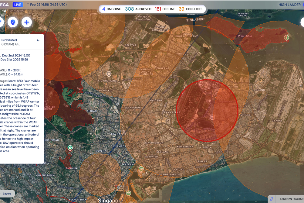
High Lander has launched Vega, software for managing constraints and sharing geo-awareness data with airspace participants, creating full ecosystem interoperability within U–spaces and harmony between manned and unmanned aircraft
High Lander Aviation is a provider of drone fleet management (DFM) and UAS traffic management (UTM) services. Vega CIS is a desktop-based platform enabling airspace managers such as ANSPs, air traffic managers (ATMs) and aviation authorities to create airspace constraints, perform Dynamic Airspace Reconfiguration (DAR), and share geo-awareness data in real time with UTM/USSP service providers and unmanned aerial system (UAS) operators.
An associated mobile app provides airspace data to end-users.
By giving aviation authorities ownership of dynamic UAS-enabled airspaces, and by enabling ecosystem-wide data synchronization both directly and via discovery and synchronization service (DSS), Vega CIS provides the basis for digital airspaces where UAS can operate at scale in safety, even when under the control of diverse operators and service providers.
Furthermore, it enables authorities to adjust UAS permissions in real-time according to air traffic control (ATC) data and flow, preventing conflicts between UAS and manned aircraft.
“Data sharing is the cornerstone of safe aviation,” said Alon Abelson, founder and CEO of High Lander. “Vega CIS exponentially simplifies the process of creating, adjusting and sharing airspace permissions while forging a vital data link between airspace authorities
and all participants in the UAS ecosystem - in other words, it’s the key to the future of aviation.”
The constraint management capabilities of Vega CIS streamline complex processes that until now had required considerable time, expertise and red tape to complete.
Through a single dashboard, aviation authorities can create three types of airspace: info zones, where UAS flight plans will be automatically approved in accordance with UTM-powered deconfliction and prioritization protocols; restricted zones, where
authorities customize permissions based on conditions and official approvals; and prohibited zones, where UAS flight plans will be automatically denied.
Airspace restrictions can be customized in granular detail according to variables including UAS size and class, mission details and regulatory approvals. Authorization can also be granted manually when required.
Furthermore, Vega CIS’ innovative NOTAM engine converts coded text-based notices into visualized airspace constraints on the dashboard map, making another time-consuming process far more achievable and helping ensure that geo-awareness data remains up to date.
“Large-scale UAS operations, including public safety drones, advanced air mobility networks and urban aerial delivery services, are not feasible in complex airspaces without dedicated digital infrastructure enabling ecosystem-wide coordination and regulatory oversight,” said Abelson.
“High Lander is proud to answer the call and enable this exciting new era of aviation with Vega CIS.”
